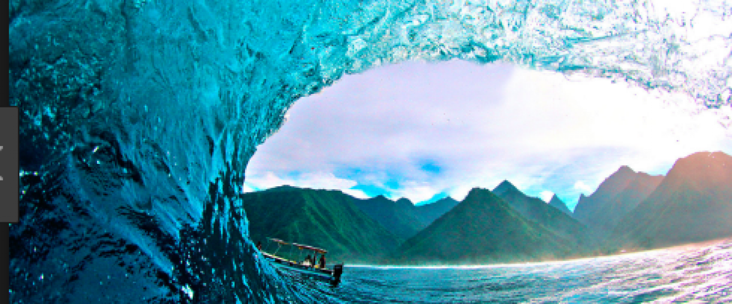

Tom Worthington gave an enticing seminar on the restoration of mangroves, where he discussed a new online app (The Mangrove Restoration Potential Map) that allows users to view the results of restoration projects. Tom explained the development of the model in great detail, and stressed the importance of mangrove restoration projects.
Fun Fact – I recently wrote my dissertation on the importance of salt marshes so I found this seminar particularly interesting!
Why is mangrove restoration so important?
Mangroves consist of shrubs and trees (~70 species), occurring in sheltered tropical coastlines throughout the world. These unique ecosystems occupy roughly 181 000km2 of coastline, occurring in a diversity of geomorphological settings. Mangroves are important for food production, carbon storage and sequestration, coastal protection, and tourism, hence there is an increasing need not only to prevent further loses, but to increase mangrove areas through restoration. Intact mangroves are more valuable than any short-term gains from coastal development. For example:
- Per hectare, mangroves can lock in 4 times more carbon than terrestrial forests.
- Mangroves absorb up to 66% of the energy from waves, acting as natural coastal defence systems, providing protection from storms and coastal erosion.
- Mangrove habitats are some of the most productive ecosystems, acting as feeding and breeding grounds for important marine species, generating income for millions.
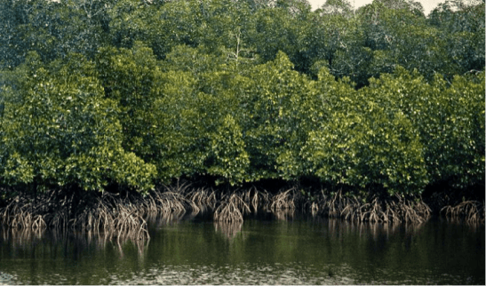
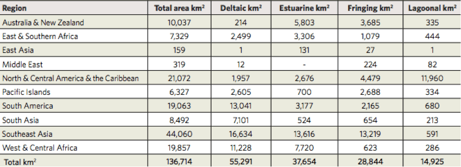
However, due to human activities mangroves have been rapidly declining over recent years. In 2016, there was roughly 136,714 km2 of mangroves while it is estimated that mangroves once covered over 200,000 km2. This rapid rate of change has increased the need for mangrove restoration projects.
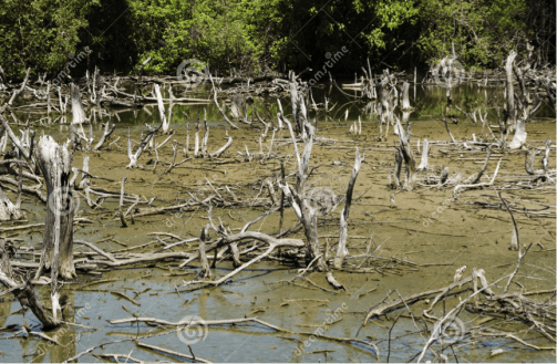
So far, these restoration projects have had very little success and the majority of planting efforts fail to restore functional mangrove forests. Successful restoration results in the establishment of a diverse, functional and self-sustaining mangrove forest that offers benefits for the environment, wildlife and people. The new online app was developed in order to highlight these benefits and illustrate where mangroves could be restored.
The App
The Mangrove Restoration Potential Map is an interactive tool developed to explore potential mangrove restoration areas worldwide and model the potential benefits associated with such restoration. The mapping tool was developed by The Nature Conservancy and IUCN, in collaboration with the University of Cambridge, and can be found on: maps.oceanwealth.org/mangrove-restoration
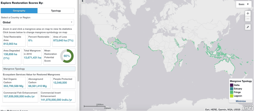
The model features information on both current and historic distribution of mangrove forests, in addition to local drivers of mangrove loss and degradation (e.g., industrial development, agriculture and aquaculture, deforestation, pollution and coastal erosion). Environmental (e.g., wave energy) and social factors (e.g., population density), as well as future projections of sea level rise, and weather events will also be integrated into the model.
Tom’s work began with the utilisation of the very latest mangrove extent maps, derived by Global Mangrove Watch (GMW), which provides a globally consistent picture of mangrove change. These were used to derive maps of mangrove losses, a key component in determining areas for restoration. The same maps, in combination with other remote-sensing techniques (including LandSAT imagery) were used to develop a model, and then to map mangrove degradation in remaining mangrove areas.
Researchers have often described broad classifications or typologies of mangroves, recognising that both physical and ecological conditions are strongly influenced by their geomorphological settings. Worthington and his colleagues felt necessary to utilise this knowledge, developing the first-ever global classification of mangroves by type, recognising four classes of mangrove:
- Estuarine – driven by riverine energy
- Deltaic- driven by riverine and tidal energy
- Lagoonal – driven by high wave energy
- Fringing – forms mangroves behind coral reefs in sheltered bays
Across the global coastline, they identified and categorised 12,000 mangrove areas based on 10 size and shape parameters (e.g. area, mouth shape, wave energy etc.). Following this, an approach using distance and catchment boundaries was used to assign each area one of the 4 mangrove classes.
Results
They found 136,000 km2 of mangroves along the global coastlines. Each category made up the following percentages of this area:
- Estuary – 27.5%
- Delta – 40.4%
- Lagoon – 10.9%
- Fringing – 21.1%
Different types of mangroves require different factors for restoration to be considered. Restoring mangroves is highly unlikely in areas that have eroded or subsided to become fully inundated by the sea, or in places that have been converted to urban buildings and infrastructure. For other areas, factors influencing mangrove restoration include:
- Tidal range
- Recent sea level rise
- Projected future sea level rise
- Recent change in sediments
- Time since loss
- Median size of loss patches
- Proximity of loss areas to remaining mangroves
An advisory team reviewed these variables and an averaged restoration potential score (from 1 to 100) was calculated for each of mangrove units under assessment.
In addition to identifying mangroves that have been lost, Tom and his team aimed to identify regions of mangrove degradation, which until now had largely been overlooked. They used the historic Landsat imagery (from 1982 onwards) to identify vegetation changes over the years, highlighting how and where mangroves have experienced degradation.
Incredible Potential
Globally there are over 8120km2 of coastal land where mangroves have been lost but where restoration is possible. In addition they have identified 1389km2 of degraded mangroves were full recovery can be expected. If all of this area is restored, 366 million tonnes of carbon storage may become available, ensuring the protection of coastlines from future sea level rise.
It is clear (thanks to Tom) that the most successful restoration projects begin with a good understanding of the conditions of the site being restored. This includes prior knowledge of both ecology and hydrology. As mangrove restoration becomes increasingly important, this map will prove useful in making sure that the restoration techniques used are effective.
Further Reading
If you found this blog particularly interesting and would like to find out more about this fantastic project you can access the map here: http://maps.oceanwealth.org/mangrove-restoration/
Thanks for reading guys!
 Geo takes GEOscience